top of page

FORE STREET MAPS


Sketch Map of Listed Buildings in fore Street in 2015
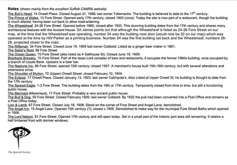
Public Houses which have existed in Fore Street (a handful still exist), indicated on a modern map, with notes:


Ordnance Survey maps (1988) showing Fore Street and surrounding area:


Aerial Photographs of Ipswich Town East and West with captions (1979):


bottom of page