- Screen Colours:
- Normal
- Black & Yellow
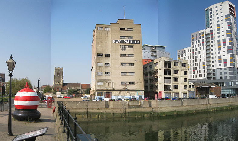
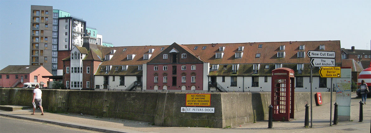
St Peter’s Dock* and its environs are seen by The Ipswich Society and others as a vital gateway into the historic waterfront. To this end, Ipswich Borough Council (IBC) has purchased buildings and land between Foundry Lane and Bridge Street, including the Benet Aldred 16th century merchant’s house at 4 College Street. At the time of writing, purchase of the ‘R&W Paul’ maltings silo is still to be finalised. IBC’s enlightened position is eventually to offer all the buildings to a developer and monitor/encourage a suitable scheme to revitalise this gateway area.
St Peter’s Dock plaza (St Peter’s Dock and Bridge Street)
Funding from the Coastal Community Fund has been secured to create an improved area of public realm alongside the River Orwell flowing under Stoke Bridge. This area should be turned into a new destination public space in conjunction with redevelopment of adjacent buildings, providing sitting-out space and prioritising pedestrian movement and people activity over vehicles.
The visual impact of the flood wall could be softened and turned into a feature referencing the maritime heritage of the area. Paving could match the quays to east. One idea is to create a ‘wall-walk’ in concrete to visually tie in with quay wall material, which allows people to see over the wall and provides informal seating at places. Handrails on the existing wall with integrated, concealed lighting would aid access. The exposed concrete on the wall could be enhanced by adding small details in steel or corten (weathering steel), referring to local maritime heritage: as an opportunity for public art. Raised planters would add much needed greenery.
A more radical solution would be to remove the raised concrete flood defence because of the protection now provided by the new Tidal Barrier – or flood-gates might be installed in the wall to enable vessels to disembark easily from the dock. Another imaginative idea would be to investigate the installation of a wooden boardwalk over the water between Albion Wharf and New Cut East, potentially stepping down to water level from the road.
Two-way vehicular access through the space will need to be retained for access to and from the Wet Dock Island, but treated in special materials which encourage sharing of the space, similar to rest of the Waterfront route. The removal of vehicle parking would reduce pollution and free up public spaces for café-type seating and all sorts of activities.
On Stoke Bridge, the pedestrian crossing could be realigned (potentially two toucan crossings) to facilitate east-west walking and cycling. In the long term, the feasibility of a new pedestrian and cycle bridge between Foundry Lane and Whip Street could be investigated which would reinstate this historic connection; this would need to open for ship access, so long as the proposed Felaw Street bridge is also openable (see accompanying article).
These ideas would assist in the visual appeal and development of the space, resolve current road user conflicts, celebrating the area’s maritime identity. Residents and visitors could reconnect to the Wet Dock and New Cut, using the amenity spaces and improved accessibility, all of which would supporting local businesses.
Bridge Street gateway (Bridge Street roundabouts)
A redesign should improve east-west and north-south connectivity, and provide a high quality public realm setting for waterfront development. Significant improvement requires changes to the Star Lane gyratory system, and depends on an ongoing wider review of traffic circulation. To account for this, two phases of improvements (short-term and long-term) are proposed by IBC.
The conflict between motor vehicle movement and pedestrian connectivity remains an issue outside the Church of St Peter: i.e. traffic flows into Star Lane and out of College Street gyratory, whilst pedestrians walk from Stoke Bridge into St Peters Street. Add cyclists into the equation, as well as the setting of Wolsey's Gate, and the issue becomes complex but not unresolvable. Phase two of the Public Realm Strategy has some interesting ideas, albeit some time into the future involving Star Lane becoming a two-way road and College Street being closed (except for access) to become a high-quality pedestrian and cycle corridor with appropriate paving treatment. (See also page 12 ‘Star Lane traffic system’ for 2008 discussions about this. -Ed)
The benefits would include reduced vehicular dominance creating a sense of arrival: an improved town image, increased useable amenity space, better air quality, noise reduction, safer roads and pedestrian and cyclist connectivity; enhancing the overall ‘legibility’ of the area – at the moment, first-time visitors to the town must be really confused, not to mention some residents.
[*Nomenclature: Ipswich Maritime Trust describes the land side quay as a ‘wharf’, and the water as ‘St Peter's Dock’ (occasionally ‘Stoke Bridge Dock’). Please also note that this article contains some notes from the IBC’s preliminary Ipswich Public Realm Strategy. -Ed.]