- Screen Colours:
- Normal
- Black & Yellow
Suffolk County Council’s current proposals for three new bridges to, and to the south of, the Island site were shown at DanceEast early in March.
The alignment of the main bridge (A) has now been settled. Discussions are continuing on the regime for opening the centre section, vital for taller craft. The amended pedestrian/cycle crossing at the lock, Bridge C, could well be the refurbished Ransomes swing bridge.
Bridge B is to span New Cut, from Felaw Street to the Island site. An extension of Mather Way would look to be a better location, but the main concern is to ensure that the proposed bridge can be opened. A fixed bridge would effectively cut access to St Peter’s Dock for craft much higher than about 1.75 metres. That would be an unbelievably short-sighted decision which would leave the dock practically unusable.
This is a very important location.
- 1. The dock is at the historic heart of the town. It is where trade across the North Sea began, at the point where the navigable Orwell met the lowest ford crossing. There is evidence of wine being imported from the Rhineland around 600 AD.
- 2. Gipeswic was the first new settlement after the Romans left Britain. St Peter’s Dock is where it started. It is therefore one of the most historic locations in the UK. Its restoration and re-use as, for example, a ‘Heritage Harbour’ would be of significant economic benefit to the area and would also enhance the attraction of pedestrian links between the dock and the town centre via St Peter’s Street.
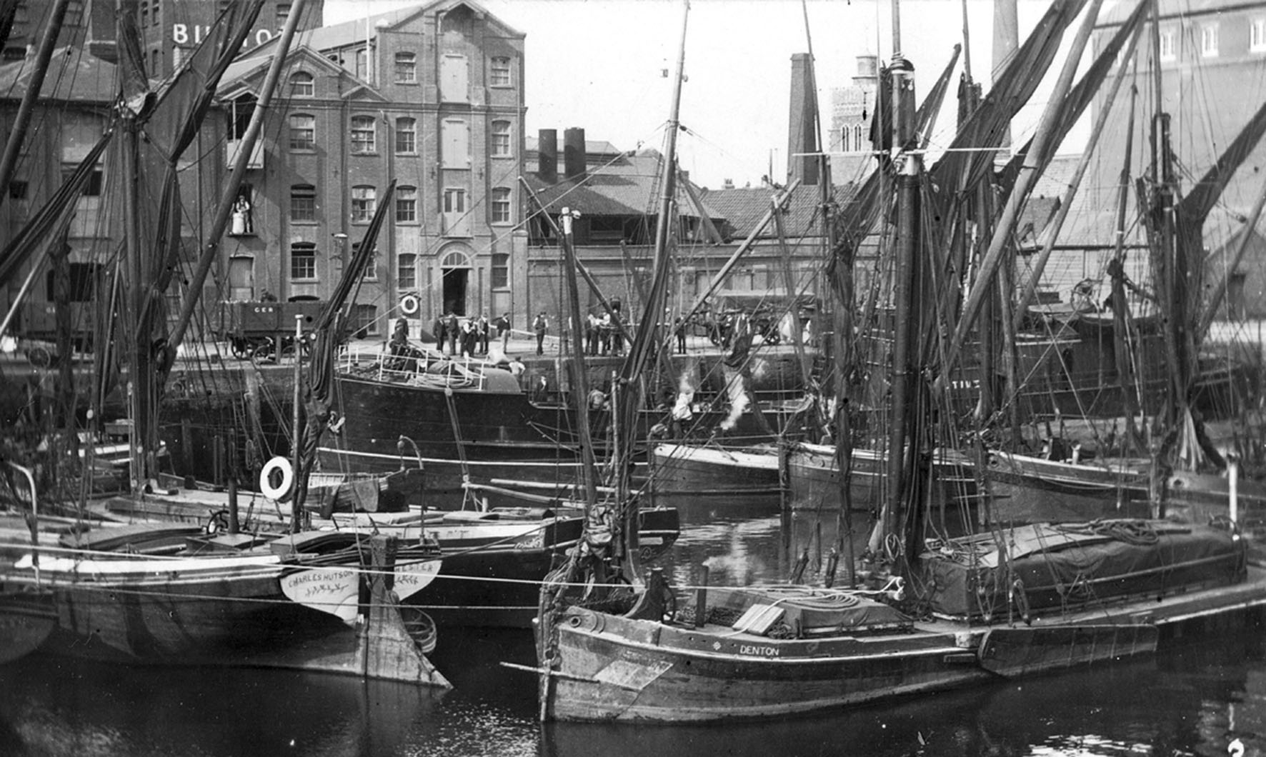
- 3. The dock was in regular use by commercial and leisure craft until the flood wall was put up in the late 1960s. That cut off access to the dock; the marina in the Wet Dock was developed, and the commercial port moved down river. The water remains.
- 4. The dock occupies a strategic location in the town’s regeneration plans. It lies at the southern end of the north-south axis and is at the entrance to the Waterfront and the Island site development area. If it is to fulfil the potential of that location, there must at the very least be retained access to the dock for historic and heritage craft. This does not mean exclusively craft with masts; smaller naval vessels, for example, would need much higher clearance than would be afforded by a level bridge over New Cut.
- 5. Emerging planning guidance for the area envisages a footway raised to flood wall level alongside the dock and an enhanced viewing area on Stoke Bridge. Ipswich Borough Council now own two of the three critical freeholds which will unlock development of the site running back from the major double roundabout to Foundry Lane.
- 6. It would not be necessary for the proposed bridge to be opened frequently, in that the historic/heritage craft would be in the dock on a semi-permanent basis. Thus the main purpose of the bridge, to provide a traffic link to the Island site, would not be compromised.
Ipswich Maritime Trust has put out its own ‘Vision’ showing how the dock could be transformed. Only access down to the water and some pontoons would be required, none of which would need major expenditure. We commissioned well-known local artist Reg Snook to envisage how the dock might look against a back-drop of the redeveloped ‘IBC’ sites. [see the painting in the article The changing Waterfront in our January 2018 issue, No. 210].
Within recent memory the dock has contained Thames barges, paddle steamers and a range of leisure craft. The vision is readily achievable. The dock is there. We will lose its potential if the New Cut bridge is to be a fixed one.
Geoffrey Dyball (Chairman of Ipswich Maritime Trust)
[Photographs above and on the front cover courtesy Stuart Grimwade (IMT).]